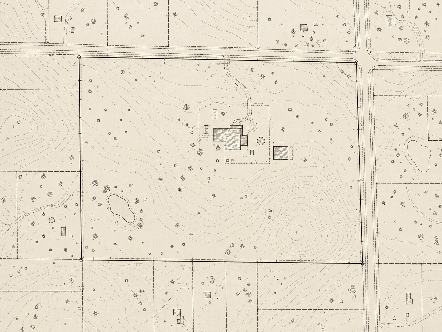
Site plans contain valuable spatial information that can be difficult to search in a static file. Hotspots provide a clear path from parcel geometry to useful context. This article is written as a practical editorial guide for teams that need a drawing to communicate clearly in a browser. It combines education, implementation tips, and recommendations that can be applied to a small demonstration before a larger rollout.
Start with the question the drawing must answer
In making site plans and parcel drawings easier to explore, the first useful decision is to define what a visitor should learn in the first few seconds. A drawing contains many lines, blocks, symbols, and coordinates, but an ordinary visitor does not approach it like a CAD operator. Explain the purpose of the view, the meaning of an interactive region, and the action that follows a selection. This simple framing prevents a visually impressive page from becoming a confusing one. Teams should write a short task statement such as finding a room, comparing a route, checking a parcel, or opening an equipment record. Use that statement when choosing the image, the scale, the labels, and the available controls. If a feature does not help the task, postpone it. This keeps the experience focused and gives the project a measurable outcome.
A dependable method separates geometry, content, and presentation. Geometry describes where an object is; content describes what the object means; presentation describes how the browser shows it. Keeping those concerns clear makes revisions safer because a changed label does not require redrawing every region. It also makes it easier to recommend different outputs for different audiences. A technician may need exact identifiers and links to documents, while a visitor may need a simple name and a short explanation. Use stable identifiers for objects, store descriptive text outside the image where possible, and make the relationship between a hotspot and its source data easy to inspect. This approach is especially valuable when a drawing is updated by several people or converted more than once.
Start with the question the drawing must answer
In making site plans and parcel drawings easier to explore, the first useful decision is to define what a visitor should learn in the first few seconds. A drawing contains many lines, blocks, symbols, and coordinates, but an ordinary visitor does not approach it like a CAD operator. Explain the purpose of the view, the meaning of an interactive region, and the action that follows a selection. This simple framing prevents a visually impressive page from becoming a confusing one. Teams should write a short task statement such as finding a room, comparing a route, checking a parcel, or opening an equipment record. Use that statement when choosing the image, the scale, the labels, and the available controls. If a feature does not help the task, postpone it. This keeps the experience focused and gives the project a measurable outcome.
A dependable method separates geometry, content, and presentation. Geometry describes where an object is; content describes what the object means; presentation describes how the browser shows it. Keeping those concerns clear makes revisions safer because a changed label does not require redrawing every region. It also makes it easier to recommend different outputs for different audiences. A technician may need exact identifiers and links to documents, while a visitor may need a simple name and a short explanation. Use stable identifiers for objects, store descriptive text outside the image where possible, and make the relationship between a hotspot and its source data easy to inspect. This approach is especially valuable when a drawing is updated by several people or converted more than once.
Start with the question the drawing must answer
In making site plans and parcel drawings easier to explore, the first useful decision is to define what a visitor should learn in the first few seconds. A drawing contains many lines, blocks, symbols, and coordinates, but an ordinary visitor does not approach it like a CAD operator. Explain the purpose of the view, the meaning of an interactive region, and the action that follows a selection. This simple framing prevents a visually impressive page from becoming a confusing one. Teams should write a short task statement such as finding a room, comparing a route, checking a parcel, or opening an equipment record. Use that statement when choosing the image, the scale, the labels, and the available controls. If a feature does not help the task, postpone it. This keeps the experience focused and gives the project a measurable outcome.
A dependable method separates geometry, content, and presentation. Geometry describes where an object is; content describes what the object means; presentation describes how the browser shows it. Keeping those concerns clear makes revisions safer because a changed label does not require redrawing every region. It also makes it easier to recommend different outputs for different audiences. A technician may need exact identifiers and links to documents, while a visitor may need a simple name and a short explanation. Use stable identifiers for objects, store descriptive text outside the image where possible, and make the relationship between a hotspot and its source data easy to inspect. This approach is especially valuable when a drawing is updated by several people or converted more than once.
Prepare the source information
In making site plans and parcel drawings easier to explore, the first useful decision is to define what a visitor should learn in the first few seconds. A drawing contains many lines, blocks, symbols, and coordinates, but an ordinary visitor does not approach it like a CAD operator. Explain the purpose of the view, the meaning of an interactive region, and the action that follows a selection. This simple framing prevents a visually impressive page from becoming a confusing one. Teams should write a short task statement such as finding a room, comparing a route, checking a parcel, or opening an equipment record. Use that statement when choosing the image, the scale, the labels, and the available controls. If a feature does not help the task, postpone it. This keeps the experience focused and gives the project a measurable outcome.
A dependable method separates geometry, content, and presentation. Geometry describes where an object is; content describes what the object means; presentation describes how the browser shows it. Keeping those concerns clear makes revisions safer because a changed label does not require redrawing every region. It also makes it easier to recommend different outputs for different audiences. A technician may need exact identifiers and links to documents, while a visitor may need a simple name and a short explanation. Use stable identifiers for objects, store descriptive text outside the image where possible, and make the relationship between a hotspot and its source data easy to inspect. This approach is especially valuable when a drawing is updated by several people or converted more than once.
Prepare the source information
In making site plans and parcel drawings easier to explore, the first useful decision is to define what a visitor should learn in the first few seconds. A drawing contains many lines, blocks, symbols, and coordinates, but an ordinary visitor does not approach it like a CAD operator. Explain the purpose of the view, the meaning of an interactive region, and the action that follows a selection. This simple framing prevents a visually impressive page from becoming a confusing one. Teams should write a short task statement such as finding a room, comparing a route, checking a parcel, or opening an equipment record. Use that statement when choosing the image, the scale, the labels, and the available controls. If a feature does not help the task, postpone it. This keeps the experience focused and gives the project a measurable outcome.
A dependable method separates geometry, content, and presentation. Geometry describes where an object is; content describes what the object means; presentation describes how the browser shows it. Keeping those concerns clear makes revisions safer because a changed label does not require redrawing every region. It also makes it easier to recommend different outputs for different audiences. A technician may need exact identifiers and links to documents, while a visitor may need a simple name and a short explanation. Use stable identifiers for objects, store descriptive text outside the image where possible, and make the relationship between a hotspot and its source data easy to inspect. This approach is especially valuable when a drawing is updated by several people or converted more than once.
Prepare the source information
In making site plans and parcel drawings easier to explore, the first useful decision is to define what a visitor should learn in the first few seconds. A drawing contains many lines, blocks, symbols, and coordinates, but an ordinary visitor does not approach it like a CAD operator. Explain the purpose of the view, the meaning of an interactive region, and the action that follows a selection. This simple framing prevents a visually impressive page from becoming a confusing one. Teams should write a short task statement such as finding a room, comparing a route, checking a parcel, or opening an equipment record. Use that statement when choosing the image, the scale, the labels, and the available controls. If a feature does not help the task, postpone it. This keeps the experience focused and gives the project a measurable outcome.
A dependable method separates geometry, content, and presentation. Geometry describes where an object is; content describes what the object means; presentation describes how the browser shows it. Keeping those concerns clear makes revisions safer because a changed label does not require redrawing every region. It also makes it easier to recommend different outputs for different audiences. A technician may need exact identifiers and links to documents, while a visitor may need a simple name and a short explanation. Use stable identifiers for objects, store descriptive text outside the image where possible, and make the relationship between a hotspot and its source data easy to inspect. This approach is especially valuable when a drawing is updated by several people or converted more than once.
Design the interaction before the interface
In making site plans and parcel drawings easier to explore, the first useful decision is to define what a visitor should learn in the first few seconds. A drawing contains many lines, blocks, symbols, and coordinates, but an ordinary visitor does not approach it like a CAD operator. Explain the purpose of the view, the meaning of an interactive region, and the action that follows a selection. This simple framing prevents a visually impressive page from becoming a confusing one. Teams should write a short task statement such as finding a room, comparing a route, checking a parcel, or opening an equipment record. Use that statement when choosing the image, the scale, the labels, and the available controls. If a feature does not help the task, postpone it. This keeps the experience focused and gives the project a measurable outcome.
A dependable method separates geometry, content, and presentation. Geometry describes where an object is; content describes what the object means; presentation describes how the browser shows it. Keeping those concerns clear makes revisions safer because a changed label does not require redrawing every region. It also makes it easier to recommend different outputs for different audiences. A technician may need exact identifiers and links to documents, while a visitor may need a simple name and a short explanation. Use stable identifiers for objects, store descriptive text outside the image where possible, and make the relationship between a hotspot and its source data easy to inspect. This approach is especially valuable when a drawing is updated by several people or converted more than once.
Design the interaction before the interface
In making site plans and parcel drawings easier to explore, the first useful decision is to define what a visitor should learn in the first few seconds. A drawing contains many lines, blocks, symbols, and coordinates, but an ordinary visitor does not approach it like a CAD operator. Explain the purpose of the view, the meaning of an interactive region, and the action that follows a selection. This simple framing prevents a visually impressive page from becoming a confusing one. Teams should write a short task statement such as finding a room, comparing a route, checking a parcel, or opening an equipment record. Use that statement when choosing the image, the scale, the labels, and the available controls. If a feature does not help the task, postpone it. This keeps the experience focused and gives the project a measurable outcome.
A dependable method separates geometry, content, and presentation. Geometry describes where an object is; content describes what the object means; presentation describes how the browser shows it. Keeping those concerns clear makes revisions safer because a changed label does not require redrawing every region. It also makes it easier to recommend different outputs for different audiences. A technician may need exact identifiers and links to documents, while a visitor may need a simple name and a short explanation. Use stable identifiers for objects, store descriptive text outside the image where possible, and make the relationship between a hotspot and its source data easy to inspect. This approach is especially valuable when a drawing is updated by several people or converted more than once.
Design the interaction before the interface
In making site plans and parcel drawings easier to explore, the first useful decision is to define what a visitor should learn in the first few seconds. A drawing contains many lines, blocks, symbols, and coordinates, but an ordinary visitor does not approach it like a CAD operator. Explain the purpose of the view, the meaning of an interactive region, and the action that follows a selection. This simple framing prevents a visually impressive page from becoming a confusing one. Teams should write a short task statement such as finding a room, comparing a route, checking a parcel, or opening an equipment record. Use that statement when choosing the image, the scale, the labels, and the available controls. If a feature does not help the task, postpone it. This keeps the experience focused and gives the project a measurable outcome.
A dependable method separates geometry, content, and presentation. Geometry describes where an object is; content describes what the object means; presentation describes how the browser shows it. Keeping those concerns clear makes revisions safer because a changed label does not require redrawing every region. It also makes it easier to recommend different outputs for different audiences. A technician may need exact identifiers and links to documents, while a visitor may need a simple name and a short explanation. Use stable identifiers for objects, store descriptive text outside the image where possible, and make the relationship between a hotspot and its source data easy to inspect. This approach is especially valuable when a drawing is updated by several people or converted more than once.
Use clear visual and written guidance
In making site plans and parcel drawings easier to explore, the first useful decision is to define what a visitor should learn in the first few seconds. A drawing contains many lines, blocks, symbols, and coordinates, but an ordinary visitor does not approach it like a CAD operator. Explain the purpose of the view, the meaning of an interactive region, and the action that follows a selection. This simple framing prevents a visually impressive page from becoming a confusing one. Teams should write a short task statement such as finding a room, comparing a route, checking a parcel, or opening an equipment record. Use that statement when choosing the image, the scale, the labels, and the available controls. If a feature does not help the task, postpone it. This keeps the experience focused and gives the project a measurable outcome.
A dependable method separates geometry, content, and presentation. Geometry describes where an object is; content describes what the object means; presentation describes how the browser shows it. Keeping those concerns clear makes revisions safer because a changed label does not require redrawing every region. It also makes it easier to recommend different outputs for different audiences. A technician may need exact identifiers and links to documents, while a visitor may need a simple name and a short explanation. Use stable identifiers for objects, store descriptive text outside the image where possible, and make the relationship between a hotspot and its source data easy to inspect. This approach is especially valuable when a drawing is updated by several people or converted more than once.
Use clear visual and written guidance
In making site plans and parcel drawings easier to explore, the first useful decision is to define what a visitor should learn in the first few seconds. A drawing contains many lines, blocks, symbols, and coordinates, but an ordinary visitor does not approach it like a CAD operator. Explain the purpose of the view, the meaning of an interactive region, and the action that follows a selection. This simple framing prevents a visually impressive page from becoming a confusing one. Teams should write a short task statement such as finding a room, comparing a route, checking a parcel, or opening an equipment record. Use that statement when choosing the image, the scale, the labels, and the available controls. If a feature does not help the task, postpone it. This keeps the experience focused and gives the project a measurable outcome.
A dependable method separates geometry, content, and presentation. Geometry describes where an object is; content describes what the object means; presentation describes how the browser shows it. Keeping those concerns clear makes revisions safer because a changed label does not require redrawing every region. It also makes it easier to recommend different outputs for different audiences. A technician may need exact identifiers and links to documents, while a visitor may need a simple name and a short explanation. Use stable identifiers for objects, store descriptive text outside the image where possible, and make the relationship between a hotspot and its source data easy to inspect. This approach is especially valuable when a drawing is updated by several people or converted more than once.
Use clear visual and written guidance
In making site plans and parcel drawings easier to explore, the first useful decision is to define what a visitor should learn in the first few seconds. A drawing contains many lines, blocks, symbols, and coordinates, but an ordinary visitor does not approach it like a CAD operator. Explain the purpose of the view, the meaning of an interactive region, and the action that follows a selection. This simple framing prevents a visually impressive page from becoming a confusing one. Teams should write a short task statement such as finding a room, comparing a route, checking a parcel, or opening an equipment record. Use that statement when choosing the image, the scale, the labels, and the available controls. If a feature does not help the task, postpone it. This keeps the experience focused and gives the project a measurable outcome.
A dependable method separates geometry, content, and presentation. Geometry describes where an object is; content describes what the object means; presentation describes how the browser shows it. Keeping those concerns clear makes revisions safer because a changed label does not require redrawing every region. It also makes it easier to recommend different outputs for different audiences. A technician may need exact identifiers and links to documents, while a visitor may need a simple name and a short explanation. Use stable identifiers for objects, store descriptive text outside the image where possible, and make the relationship between a hotspot and its source data easy to inspect. This approach is especially valuable when a drawing is updated by several people or converted more than once.
Build a repeatable conversion process
In making site plans and parcel drawings easier to explore, the first useful decision is to define what a visitor should learn in the first few seconds. A drawing contains many lines, blocks, symbols, and coordinates, but an ordinary visitor does not approach it like a CAD operator. Explain the purpose of the view, the meaning of an interactive region, and the action that follows a selection. This simple framing prevents a visually impressive page from becoming a confusing one. Teams should write a short task statement such as finding a room, comparing a route, checking a parcel, or opening an equipment record. Use that statement when choosing the image, the scale, the labels, and the available controls. If a feature does not help the task, postpone it. This keeps the experience focused and gives the project a measurable outcome.
A dependable method separates geometry, content, and presentation. Geometry describes where an object is; content describes what the object means; presentation describes how the browser shows it. Keeping those concerns clear makes revisions safer because a changed label does not require redrawing every region. It also makes it easier to recommend different outputs for different audiences. A technician may need exact identifiers and links to documents, while a visitor may need a simple name and a short explanation. Use stable identifiers for objects, store descriptive text outside the image where possible, and make the relationship between a hotspot and its source data easy to inspect. This approach is especially valuable when a drawing is updated by several people or converted more than once.
Build a repeatable conversion process
In making site plans and parcel drawings easier to explore, the first useful decision is to define what a visitor should learn in the first few seconds. A drawing contains many lines, blocks, symbols, and coordinates, but an ordinary visitor does not approach it like a CAD operator. Explain the purpose of the view, the meaning of an interactive region, and the action that follows a selection. This simple framing prevents a visually impressive page from becoming a confusing one. Teams should write a short task statement such as finding a room, comparing a route, checking a parcel, or opening an equipment record. Use that statement when choosing the image, the scale, the labels, and the available controls. If a feature does not help the task, postpone it. This keeps the experience focused and gives the project a measurable outcome.
A dependable method separates geometry, content, and presentation. Geometry describes where an object is; content describes what the object means; presentation describes how the browser shows it. Keeping those concerns clear makes revisions safer because a changed label does not require redrawing every region. It also makes it easier to recommend different outputs for different audiences. A technician may need exact identifiers and links to documents, while a visitor may need a simple name and a short explanation. Use stable identifiers for objects, store descriptive text outside the image where possible, and make the relationship between a hotspot and its source data easy to inspect. This approach is especially valuable when a drawing is updated by several people or converted more than once.
Build a repeatable conversion process
In making site plans and parcel drawings easier to explore, the first useful decision is to define what a visitor should learn in the first few seconds. A drawing contains many lines, blocks, symbols, and coordinates, but an ordinary visitor does not approach it like a CAD operator. Explain the purpose of the view, the meaning of an interactive region, and the action that follows a selection. This simple framing prevents a visually impressive page from becoming a confusing one. Teams should write a short task statement such as finding a room, comparing a route, checking a parcel, or opening an equipment record. Use that statement when choosing the image, the scale, the labels, and the available controls. If a feature does not help the task, postpone it. This keeps the experience focused and gives the project a measurable outcome.
A dependable method separates geometry, content, and presentation. Geometry describes where an object is; content describes what the object means; presentation describes how the browser shows it. Keeping those concerns clear makes revisions safer because a changed label does not require redrawing every region. It also makes it easier to recommend different outputs for different audiences. A technician may need exact identifiers and links to documents, while a visitor may need a simple name and a short explanation. Use stable identifiers for objects, store descriptive text outside the image where possible, and make the relationship between a hotspot and its source data easy to inspect. This approach is especially valuable when a drawing is updated by several people or converted more than once.
Test with real users and real conditions
In making site plans and parcel drawings easier to explore, the first useful decision is to define what a visitor should learn in the first few seconds. A drawing contains many lines, blocks, symbols, and coordinates, but an ordinary visitor does not approach it like a CAD operator. Explain the purpose of the view, the meaning of an interactive region, and the action that follows a selection. This simple framing prevents a visually impressive page from becoming a confusing one. Teams should write a short task statement such as finding a room, comparing a route, checking a parcel, or opening an equipment record. Use that statement when choosing the image, the scale, the labels, and the available controls. If a feature does not help the task, postpone it. This keeps the experience focused and gives the project a measurable outcome.
A dependable method separates geometry, content, and presentation. Geometry describes where an object is; content describes what the object means; presentation describes how the browser shows it. Keeping those concerns clear makes revisions safer because a changed label does not require redrawing every region. It also makes it easier to recommend different outputs for different audiences. A technician may need exact identifiers and links to documents, while a visitor may need a simple name and a short explanation. Use stable identifiers for objects, store descriptive text outside the image where possible, and make the relationship between a hotspot and its source data easy to inspect. This approach is especially valuable when a drawing is updated by several people or converted more than once.
Test with real users and real conditions
In making site plans and parcel drawings easier to explore, the first useful decision is to define what a visitor should learn in the first few seconds. A drawing contains many lines, blocks, symbols, and coordinates, but an ordinary visitor does not approach it like a CAD operator. Explain the purpose of the view, the meaning of an interactive region, and the action that follows a selection. This simple framing prevents a visually impressive page from becoming a confusing one. Teams should write a short task statement such as finding a room, comparing a route, checking a parcel, or opening an equipment record. Use that statement when choosing the image, the scale, the labels, and the available controls. If a feature does not help the task, postpone it. This keeps the experience focused and gives the project a measurable outcome.
A dependable method separates geometry, content, and presentation. Geometry describes where an object is; content describes what the object means; presentation describes how the browser shows it. Keeping those concerns clear makes revisions safer because a changed label does not require redrawing every region. It also makes it easier to recommend different outputs for different audiences. A technician may need exact identifiers and links to documents, while a visitor may need a simple name and a short explanation. Use stable identifiers for objects, store descriptive text outside the image where possible, and make the relationship between a hotspot and its source data easy to inspect. This approach is especially valuable when a drawing is updated by several people or converted more than once.
Test with real users and real conditions
In making site plans and parcel drawings easier to explore, the first useful decision is to define what a visitor should learn in the first few seconds. A drawing contains many lines, blocks, symbols, and coordinates, but an ordinary visitor does not approach it like a CAD operator. Explain the purpose of the view, the meaning of an interactive region, and the action that follows a selection. This simple framing prevents a visually impressive page from becoming a confusing one. Teams should write a short task statement such as finding a room, comparing a route, checking a parcel, or opening an equipment record. Use that statement when choosing the image, the scale, the labels, and the available controls. If a feature does not help the task, postpone it. This keeps the experience focused and gives the project a measurable outcome.
A dependable method separates geometry, content, and presentation. Geometry describes where an object is; content describes what the object means; presentation describes how the browser shows it. Keeping those concerns clear makes revisions safer because a changed label does not require redrawing every region. It also makes it easier to recommend different outputs for different audiences. A technician may need exact identifiers and links to documents, while a visitor may need a simple name and a short explanation. Use stable identifiers for objects, store descriptive text outside the image where possible, and make the relationship between a hotspot and its source data easy to inspect. This approach is especially valuable when a drawing is updated by several people or converted more than once.
Plan ownership and maintenance
In making site plans and parcel drawings easier to explore, the first useful decision is to define what a visitor should learn in the first few seconds. A drawing contains many lines, blocks, symbols, and coordinates, but an ordinary visitor does not approach it like a CAD operator. Explain the purpose of the view, the meaning of an interactive region, and the action that follows a selection. This simple framing prevents a visually impressive page from becoming a confusing one. Teams should write a short task statement such as finding a room, comparing a route, checking a parcel, or opening an equipment record. Use that statement when choosing the image, the scale, the labels, and the available controls. If a feature does not help the task, postpone it. This keeps the experience focused and gives the project a measurable outcome.
A dependable method separates geometry, content, and presentation. Geometry describes where an object is; content describes what the object means; presentation describes how the browser shows it. Keeping those concerns clear makes revisions safer because a changed label does not require redrawing every region. It also makes it easier to recommend different outputs for different audiences. A technician may need exact identifiers and links to documents, while a visitor may need a simple name and a short explanation. Use stable identifiers for objects, store descriptive text outside the image where possible, and make the relationship between a hotspot and its source data easy to inspect. This approach is especially valuable when a drawing is updated by several people or converted more than once.
Plan ownership and maintenance
In making site plans and parcel drawings easier to explore, the first useful decision is to define what a visitor should learn in the first few seconds. A drawing contains many lines, blocks, symbols, and coordinates, but an ordinary visitor does not approach it like a CAD operator. Explain the purpose of the view, the meaning of an interactive region, and the action that follows a selection. This simple framing prevents a visually impressive page from becoming a confusing one. Teams should write a short task statement such as finding a room, comparing a route, checking a parcel, or opening an equipment record. Use that statement when choosing the image, the scale, the labels, and the available controls. If a feature does not help the task, postpone it. This keeps the experience focused and gives the project a measurable outcome.
A dependable method separates geometry, content, and presentation. Geometry describes where an object is; content describes what the object means; presentation describes how the browser shows it. Keeping those concerns clear makes revisions safer because a changed label does not require redrawing every region. It also makes it easier to recommend different outputs for different audiences. A technician may need exact identifiers and links to documents, while a visitor may need a simple name and a short explanation. Use stable identifiers for objects, store descriptive text outside the image where possible, and make the relationship between a hotspot and its source data easy to inspect. This approach is especially valuable when a drawing is updated by several people or converted more than once.
Plan ownership and maintenance
In making site plans and parcel drawings easier to explore, the first useful decision is to define what a visitor should learn in the first few seconds. A drawing contains many lines, blocks, symbols, and coordinates, but an ordinary visitor does not approach it like a CAD operator. Explain the purpose of the view, the meaning of an interactive region, and the action that follows a selection. This simple framing prevents a visually impressive page from becoming a confusing one. Teams should write a short task statement such as finding a room, comparing a route, checking a parcel, or opening an equipment record. Use that statement when choosing the image, the scale, the labels, and the available controls. If a feature does not help the task, postpone it. This keeps the experience focused and gives the project a measurable outcome.
A dependable method separates geometry, content, and presentation. Geometry describes where an object is; content describes what the object means; presentation describes how the browser shows it. Keeping those concerns clear makes revisions safer because a changed label does not require redrawing every region. It also makes it easier to recommend different outputs for different audiences. A technician may need exact identifiers and links to documents, while a visitor may need a simple name and a short explanation. Use stable identifiers for objects, store descriptive text outside the image where possible, and make the relationship between a hotspot and its source data easy to inspect. This approach is especially valuable when a drawing is updated by several people or converted more than once.
Common mistakes to avoid
In making site plans and parcel drawings easier to explore, the first useful decision is to define what a visitor should learn in the first few seconds. A drawing contains many lines, blocks, symbols, and coordinates, but an ordinary visitor does not approach it like a CAD operator. Explain the purpose of the view, the meaning of an interactive region, and the action that follows a selection. This simple framing prevents a visually impressive page from becoming a confusing one. Teams should write a short task statement such as finding a room, comparing a route, checking a parcel, or opening an equipment record. Use that statement when choosing the image, the scale, the labels, and the available controls. If a feature does not help the task, postpone it. This keeps the experience focused and gives the project a measurable outcome.
A dependable method separates geometry, content, and presentation. Geometry describes where an object is; content describes what the object means; presentation describes how the browser shows it. Keeping those concerns clear makes revisions safer because a changed label does not require redrawing every region. It also makes it easier to recommend different outputs for different audiences. A technician may need exact identifiers and links to documents, while a visitor may need a simple name and a short explanation. Use stable identifiers for objects, store descriptive text outside the image where possible, and make the relationship between a hotspot and its source data easy to inspect. This approach is especially valuable when a drawing is updated by several people or converted more than once.
Common mistakes to avoid
In making site plans and parcel drawings easier to explore, the first useful decision is to define what a visitor should learn in the first few seconds. A drawing contains many lines, blocks, symbols, and coordinates, but an ordinary visitor does not approach it like a CAD operator. Explain the purpose of the view, the meaning of an interactive region, and the action that follows a selection. This simple framing prevents a visually impressive page from becoming a confusing one. Teams should write a short task statement such as finding a room, comparing a route, checking a parcel, or opening an equipment record. Use that statement when choosing the image, the scale, the labels, and the available controls. If a feature does not help the task, postpone it. This keeps the experience focused and gives the project a measurable outcome.
A dependable method separates geometry, content, and presentation. Geometry describes where an object is; content describes what the object means; presentation describes how the browser shows it. Keeping those concerns clear makes revisions safer because a changed label does not require redrawing every region. It also makes it easier to recommend different outputs for different audiences. A technician may need exact identifiers and links to documents, while a visitor may need a simple name and a short explanation. Use stable identifiers for objects, store descriptive text outside the image where possible, and make the relationship between a hotspot and its source data easy to inspect. This approach is especially valuable when a drawing is updated by several people or converted more than once.
Common mistakes to avoid
In making site plans and parcel drawings easier to explore, the first useful decision is to define what a visitor should learn in the first few seconds. A drawing contains many lines, blocks, symbols, and coordinates, but an ordinary visitor does not approach it like a CAD operator. Explain the purpose of the view, the meaning of an interactive region, and the action that follows a selection. This simple framing prevents a visually impressive page from becoming a confusing one. Teams should write a short task statement such as finding a room, comparing a route, checking a parcel, or opening an equipment record. Use that statement when choosing the image, the scale, the labels, and the available controls. If a feature does not help the task, postpone it. This keeps the experience focused and gives the project a measurable outcome.
A dependable method separates geometry, content, and presentation. Geometry describes where an object is; content describes what the object means; presentation describes how the browser shows it. Keeping those concerns clear makes revisions safer because a changed label does not require redrawing every region. It also makes it easier to recommend different outputs for different audiences. A technician may need exact identifiers and links to documents, while a visitor may need a simple name and a short explanation. Use stable identifiers for objects, store descriptive text outside the image where possible, and make the relationship between a hotspot and its source data easy to inspect. This approach is especially valuable when a drawing is updated by several people or converted more than once.
A practical recommendation for your next project
In making site plans and parcel drawings easier to explore, the first useful decision is to define what a visitor should learn in the first few seconds. A drawing contains many lines, blocks, symbols, and coordinates, but an ordinary visitor does not approach it like a CAD operator. Explain the purpose of the view, the meaning of an interactive region, and the action that follows a selection. This simple framing prevents a visually impressive page from becoming a confusing one. Teams should write a short task statement such as finding a room, comparing a route, checking a parcel, or opening an equipment record. Use that statement when choosing the image, the scale, the labels, and the available controls. If a feature does not help the task, postpone it. This keeps the experience focused and gives the project a measurable outcome.
A dependable method separates geometry, content, and presentation. Geometry describes where an object is; content describes what the object means; presentation describes how the browser shows it. Keeping those concerns clear makes revisions safer because a changed label does not require redrawing every region. It also makes it easier to recommend different outputs for different audiences. A technician may need exact identifiers and links to documents, while a visitor may need a simple name and a short explanation. Use stable identifiers for objects, store descriptive text outside the image where possible, and make the relationship between a hotspot and its source data easy to inspect. This approach is especially valuable when a drawing is updated by several people or converted more than once.
A practical recommendation for your next project
In making site plans and parcel drawings easier to explore, the first useful decision is to define what a visitor should learn in the first few seconds. A drawing contains many lines, blocks, symbols, and coordinates, but an ordinary visitor does not approach it like a CAD operator. Explain the purpose of the view, the meaning of an interactive region, and the action that follows a selection. This simple framing prevents a visually impressive page from becoming a confusing one. Teams should write a short task statement such as finding a room, comparing a route, checking a parcel, or opening an equipment record. Use that statement when choosing the image, the scale, the labels, and the available controls. If a feature does not help the task, postpone it. This keeps the experience focused and gives the project a measurable outcome.
A dependable method separates geometry, content, and presentation. Geometry describes where an object is; content describes what the object means; presentation describes how the browser shows it. Keeping those concerns clear makes revisions safer because a changed label does not require redrawing every region. It also makes it easier to recommend different outputs for different audiences. A technician may need exact identifiers and links to documents, while a visitor may need a simple name and a short explanation. Use stable identifiers for objects, store descriptive text outside the image where possible, and make the relationship between a hotspot and its source data easy to inspect. This approach is especially valuable when a drawing is updated by several people or converted more than once.
A practical recommendation for your next project
In making site plans and parcel drawings easier to explore, the first useful decision is to define what a visitor should learn in the first few seconds. A drawing contains many lines, blocks, symbols, and coordinates, but an ordinary visitor does not approach it like a CAD operator. Explain the purpose of the view, the meaning of an interactive region, and the action that follows a selection. This simple framing prevents a visually impressive page from becoming a confusing one. Teams should write a short task statement such as finding a room, comparing a route, checking a parcel, or opening an equipment record. Use that statement when choosing the image, the scale, the labels, and the available controls. If a feature does not help the task, postpone it. This keeps the experience focused and gives the project a measurable outcome.
A dependable method separates geometry, content, and presentation. Geometry describes where an object is; content describes what the object means; presentation describes how the browser shows it. Keeping those concerns clear makes revisions safer because a changed label does not require redrawing every region. It also makes it easier to recommend different outputs for different audiences. A technician may need exact identifiers and links to documents, while a visitor may need a simple name and a short explanation. Use stable identifiers for objects, store descriptive text outside the image where possible, and make the relationship between a hotspot and its source data easy to inspect. This approach is especially valuable when a drawing is updated by several people or converted more than once.